State: Victoria
Approx. centre coordinates: -37.254409790039, 145.79655456543 (latitude, longitude)
Description
Goulburn River System
Points of Interest
Project
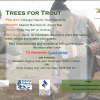
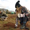
North East Rivers Access (Delatite, Goulburn, Howqua, Jamieson rivers), Steavenson River Tree Planting
Tailwater: Live river data
Acheron River, Alexandra Bridge (Eglinton Creek), Breakaway Bridge Acheron (Goulburn River), Brooks River Reserve (Ultima Thule Creek), Don Lake, Healesville, Ghin Ghin (Goulburn River), Gilmores Bridge (Goulburn River), Golf Course Dam, Longwood, Goulburn Park Guild St (Goulburn River), Greenslopes (Goulburn River), Horseshoe Lagoon Camping Reserve (Goulburn River), Kendals A (Rubicon River), Kerrisdale (Goulburn River), Killingworth River Reserve (Goulburn River), Marysville Lake, McMartins Road (Goulburn River), New Crossing River Reserve (Goulburn River), Point Hill (Goulburn River), Rubicon River, Sizzlers (Goulburn River), Steavenson River, Marysville, Thornton Beach (Goulburn River), Tumbling Waters (Rubicon River), Yarra River — Warburton/Millgrove